




ISRO successfully launches NVS-03 satellite to boost navigation system
Sat 31 Oct 2026, 01:22:56
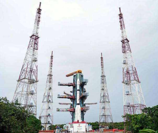
Indian Space Research Organisation (ISRO) on Friday night successfully launched the NVS-03 navigation satellite aboard its GSLV-F18 rocket from the Second Launch Pad at the Satish Dhawan Space Centre in Sriharikota, Andhra Pradesh. The launch took place at 11:51 pm IST on October 30, marking the 20th flight of India's Geosynchronous Satellite Launch Vehicle.
NavIC, or Navigation with Indian Constellation, is India's indigenous satellite navigation system developed by ISRO. Earlier known as the Indian Regional Navigation Satellite
System (IRNSS), it provides positioning, navigation and timing services over India and the surrounding region.
System (IRNSS), it provides positioning, navigation and timing services over India and the surrounding region.
The system was developed to reduce India's dependence on foreign satellite navigation networks and provide an independent source of location and timing information. NavIC was designed to cover the Indian mainland and an area extending approximately 1,500 km beyond the country's boundaries. Its applications include transport, maritime navigation, disaster management, location-based services and timing synchronisation.
No Comments For This Post, Be first to write a Comment.
Most viewed from National












Most viewed from World













Todays Epaper

English Weekly


AIMIM News





Latest Urdu News
Most Viewed
Aug 02, 2026
Should India introduce stricter laws against AI-generated fake videos and images?
Like Us
Home
About Us
Advertise With Us
All Polls
Epaper Archives
Privacy Policy
Contact Us
Download Etemaad App
© 2026 Etemaad Daily News, All Rights Reserved.