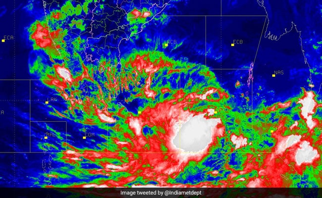
Cyclone Fani likely to intensify into severe Cyclonic Storm today
Mon 29 Apr 2019, 11:09:12

The Cyclone Fani in South East Bay of Bengal is expected to intensify into a severe cyclonic storm by this noon. India Meteorology Department said it will further intensify into a very severe cyclonic storm by tomorrow morning. It is moving in a north westwards direction at a speed of 21 kilometres per hour.
Cyclone Fani, when observed last time, was laying centred at 910 kilometres south-east of Chennai and 1090 km from Machilipattinam.It is expected to continue to travel in North West direction till Wednesday and then recurve to proceed in the north-northeast direction.
Kerala is expected to get light to moderate rain at many places today and tomorrow and heavy rain at isolated pockets. A few places in north coastal Tamil Nadu and south coastal Andhra Pradesh are predicted to have light to moderate showers for the next two
days.
days.
A few places in coastal Odisha are set to get moderate rainfall on May 2nd and heavy rainfall on May 3rd. Fishermen have been asked not to venture into the deep sea in South East Bay and the adjoining equatorial Indian Ocean.
"The cyclone threat for Tamil Nadu and Puducherry has subsided with the cyclone Fani keeping away from anywhere near the shores. The forecast on rainfall also does not bring cheers to the public as it talks of just a scanty rainfall in limited pockets.
Weather enthusiasts point out that in the past, similar cyclones during summer months that recurved have left the atmosphere high and dry, resulting in soaring temperatures after its passing. If cyclone Fani is going to be a repeat of the same needs to be observed.
No Comments For This Post, Be first to write a Comment.
Most viewed from National
Most viewed from World
AIMIM News
Latest Urdu News
Most Viewed
May 26, 2020
Which cricket team is your favourite to win the T20 World Cup 2026?
Latest Videos View All
Like Us
Home
About Us
Advertise With Us
All Polls
Epaper Archives
Privacy Policy
Contact Us
Download Etemaad App
© 2026 Etemaad Daily News, All Rights Reserved.


.jpg)


.jpg)
.jpg)
.jpg)


