


AP New State Map With 28 Districts, Amaravati As Capital City Released
Sat 04 Apr 2026, 17:22:02
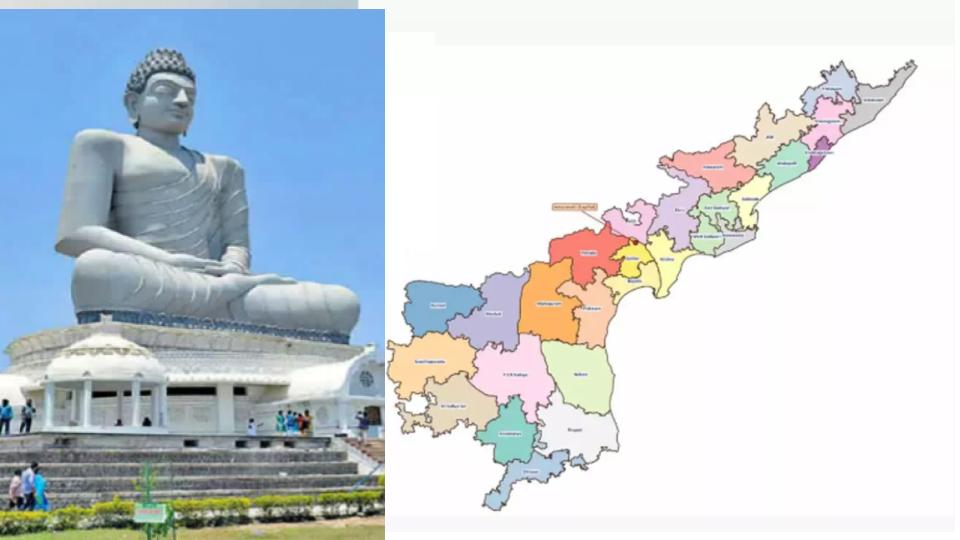
Marking the beginning of key changes in the administrative structure of Andhra Pradesh, a new state map comprising 28 districts was recently released along with specific marking of Amaravati as the state capital in Guntur district.
The Disaster Management Agency released the new map on Saturday.
The release of this map comes in the wake of the recent approval of both Houses in the Parliament passing the Andhra Pradesh Reorganisation (Amendment) Bill, formally recognising Amaravati as the sole capital of AP, more than a
decade after the erstwhile united State was bifurcated.
decade after the erstwhile united State was bifurcated.
Andhra Pradesh previously consisted of only 26 districts during the YSRCP regime, but the total count has now been increased to 28 districts with the creation of two new districts, Polavaram and Markapuram, recently by the TDP-led Government.
While Polavaram district was carved out of the Alluri Sitharama Raju district’s Ramachodavaram and Chinturu revenue divisions, Markapuram has been carved out of Prakasam district’s Markapuram and Kanigiri revenue divisions.
No Comments For This Post, Be first to write a Comment.
Most viewed from National


Most viewed from World


Todays Epaper

English Weekly


AIMIM News


Latest Urdu News
Most Viewed
May 26, 2020
Which cricket team is your favourite to win the T20 World Cup 2026?
Latest Videos View All
.jpg)
.jpg)
.jpg)


Like Us
Home
About Us
Advertise With Us
All Polls
Epaper Archives
Privacy Policy
Contact Us
Download Etemaad App
© 2026 Etemaad Daily News, All Rights Reserved.