




UN Approves Resolution in Support of Map 'Africa's True Size'
Sat 05 Sep 2026, 11:19:04
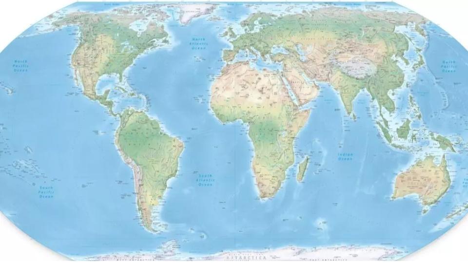
The United Nations on ?Friday voted for a shift away from the 16th-century Mercator global map towards one more accurately reflecting countries' true size, a resolution sponsored by African states to counter perceptions that the continent is peripheral.
Togo led the initiative to further the African Union campaign to ?limit use of the Mercator map, which distorts the relative size of land masses by expanding ?those nearer the poles. It makes Greenland appear roughly the same size as Africa,
?though Africa is about 14 times larger.
?though Africa is about 14 times larger.
"A fair world begins with a fair map," Togo's Foreign Minister Robert ?Dussey told Reuters ahead of Friday's vote.
The resolution promotes the Equal Earth projection, which more accurately portrays the ?size of the continents. It is not legally binding and it "in no way challenges the use of the Mercator projection for maritime and aerial navigation, for which it remains fully suited," the Togolese ministry said in a statement.
No Comments For This Post, Be first to write a Comment.
Most viewed from International



Most viewed from World










Todays Epaper

English Weekly


AIMIM News

Latest Urdu News
Most Viewed
Aug 02, 2026
Should India introduce stricter laws against AI-generated fake videos and images?
Like Us
Home
About Us
Advertise With Us
All Polls
Epaper Archives
Privacy Policy
Contact Us
Download Etemaad App
© 2026 Etemaad Daily News, All Rights Reserved.