


Israel’s military apologises for incorrect depiction of India’s map
Sat 14 Jun 2025, 11:45:31
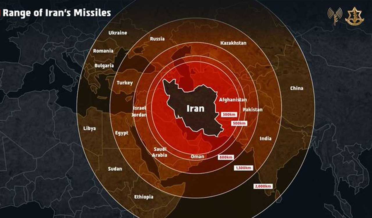
Jerusalem: The Israeli military on Saturday apologised for posting a map that incorrectly depicted Jammu and Kashmir as part of Pakistan after objections from Indian social media users, clarifying that the image “fails to precisely depict borders”.
The map was posted by the Israeli Defence Forces (IDF) on their X handle on Friday to show the range of Iranian missiles. The post quickly drew criticism from social media users in India. “Now you understand why India remains neutral. In diplomacy, no one’s really your friend,” one user commented on X.
In response, the IDF admitted that the map “fails to precisely depict borders”. “This post is an illustration of the region. This map fails to precisely depict borders. We apologize for any
offense caused by this image,” IDF said on X.
offense caused by this image,” IDF said on X.
“Iran is a global threat. Israel is not the end goal, it’s only the beginning. We had no other choice but to act,” the IDF earlier posted along with the incorrect map, justifying the launch of Operation Rising Lion against Iran.
The Israeli Air Force also posted a short video carrying a similar map, showing the range of the Iranian missiles.
In response to the controversy, Israeli Ambassador to India Reuven Azar on X described the map as “bad unintended” infographics. He said he had already asked to get the map removed/fixed. India has consistently maintained that Jammu and Kashmir, along with Ladakh, is an integral part of the country.
No Comments For This Post, Be first to write a Comment.
Most viewed from International


Most viewed from World


Todays Epaper
English Weekly


AIMIM News


Latest Urdu News
Most Viewed
May 26, 2020
Which cricket teams will reach the IPL 2026 finals?
Latest Videos View All
.jpg)
.jpg)
.jpg)


Like Us
Home
About Us
Advertise With Us
All Polls
Epaper Archives
Privacy Policy
Contact Us
Download Etemaad App
© 2026 Etemaad Daily News, All Rights Reserved.