Urdu
Matrimonials
Classifieds
World
Business
Sports
Entertainment
Health
Crime
Edu and Jobs
Politics
Photos
Videos
Menu
Home
>
World
>
International
Hyderabad
National
International
Thu 01 Jan 1970
Share
Tweet
No Comments For This Post, Be first to write a Comment.
Leave a Comment
Name:
Email:
Comment:
Enter the code shown:
Can't read the image? click
here
to refresh
Most viewed from
International
'US must respond': Trump admits Iran shot down Apache helicopter over Strait of Hormuz...
Sri Lanka Emerging as a New Base for Asia?s Scam Networks...
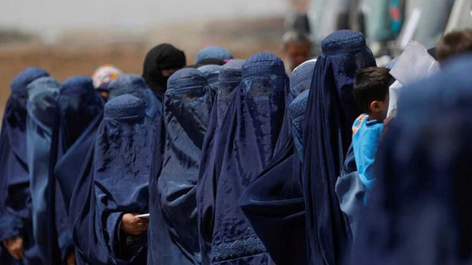
UN Urges Afghan Taliban To End Arrests Of Women Over Dress Rules...
US Military Chopper Crashes Near Hormuz, Crew Rescued...
Ebola cases rise to 550 in Congo as outbreak trend remains upward...
Tehran Airport Reopens After Flight Suspensions...
Hundreds of People Evacuated as Waves Batter New Zealand Capital...
Katz 'Israel to Continue Operations Against Hezbollah'...
France and Germany Pull Out of Joint Fighter Jet Initiative...
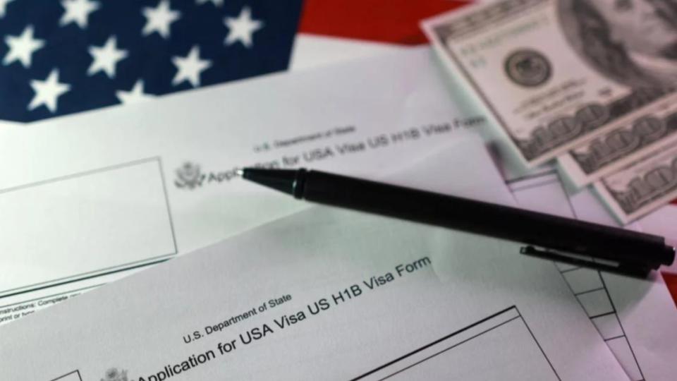
US Lawmakers Welcome Court Order Scrapping $100,000 H-1B Visa Fee...
Several Indian workers killed in Dubai after minibus collides with truck...
Yemen's Houthis declare total ban on Israeli ships in Red Sea...
Most viewed from
World
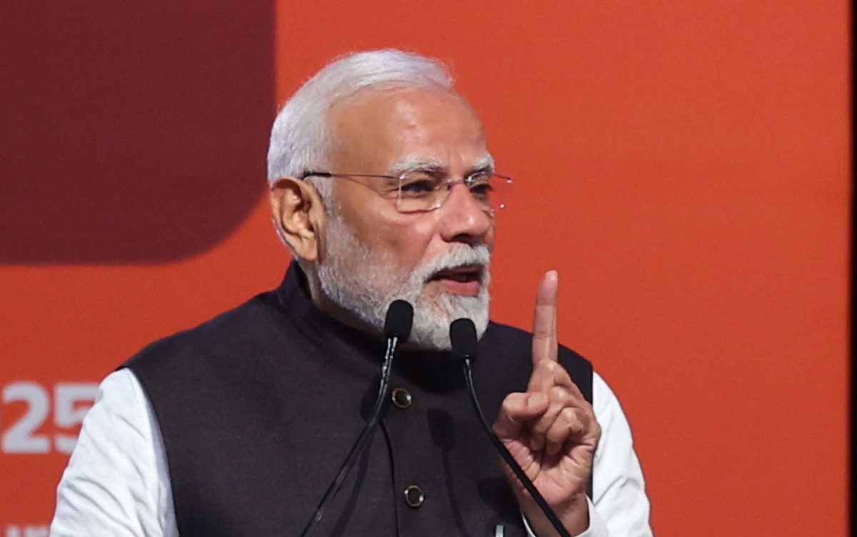
PM Modi to attend G7 Summit in France, visit Slovakia from June 13 to 18...
Congress leader Meenakshi Natarajan's Rajya Sabha nomination cancelled...
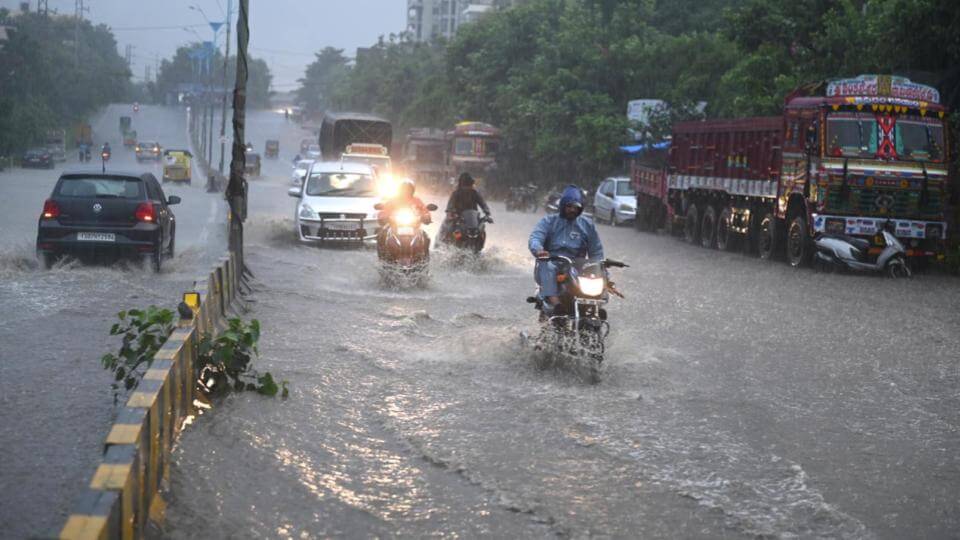
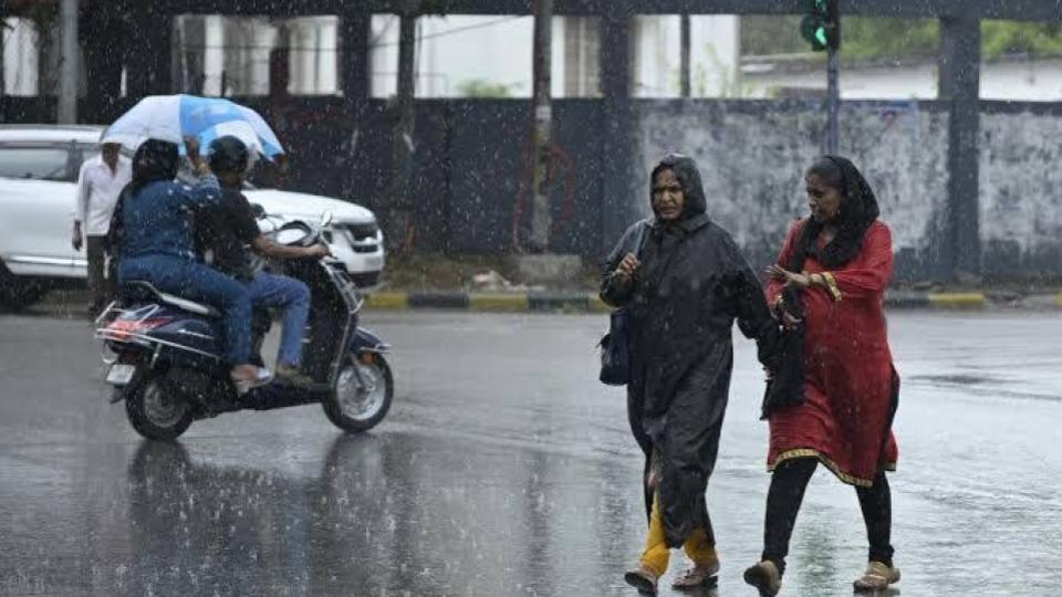
Heavy rain lashes Hyderabad, IMD says monsoon yet to arrive...
Three Telangana workers among the dead in Dubai fatal road mishap...
Hyderabad woman held at RGIA with 2.15 kg hydroponic ganja from Bangkok...
Passers-by escape as Devan Devdi Gate wall collapses ...
Visitors flock to Hyderabad for fish prasadam event...
Woman Dies By Suicide Due To Harassment In Jagtial...
Vijay Launches All Women Police Task Force ?Singappen?...
IMD Hyderabad issues 48-hour heavy rainfall alert for Telangana districts...
Over 30 UK universities to participate in NISAU UK 2026 in Hyderabad...
TGSRTC warns job aspirants against recruitment frauds...
Todays Epaper
English Weekly
AIMIM News
AIMIM Qutbullapur President Mohammed Muneeruddin interact with locals of Bachupally residents over absence of worship places
Jun 07, 2026
Latest Urdu News
کیرالا کے اسکول میں 30 مسلم طلبہ کو مبینہ طور پر داخلہ دینے سے انکار
مولانا توصیف رضا مظہری قتل کیس میں اہم پیش رفت، ملزم گرفتار
مسلم خاتون کا قاتل، بہار کی وزیر کے ساتھ نظر آیا
اتر پردیش میں مزید دو مدارس کو مہر بند کر دیا گیا
انجنا نے خان سر پر دو کروڑ ہرجانہ کا دعویٰ ٹھوک دیا
صدر مجلس کے ہاتھوں پتھر گٹی ڈویژن میں 3 کروڑ 24 لاکھ روپے کے ترقیاتی کاموں کا افتتاح
قطب اللہ پور : باچوپلی ڈبل بیڈ روم کالونی میں مسجد، مندر اور چرچ کی عدم دستیابی پر عوام میں تشویش
مکہ میوزیم میں قرآن کریم کے قدیم ترین نایاب نسخہ کی نمائش
7 کمسن بچے پانی میں غرق
مسلم خواتین کے خلاف توہین آمیز ریمارکس
واٹر بورڈ کے نام پر سائبر دھوکہ
ارونا چل پردیش میں تین جامع مساجد کو مہر بند کر دیا گیا مقامی تنظیم کی درخواست پر ایٹانگر انتظامیہ کی کاروائی
دہلی آتشزدگی واقعہ میں ٥ مسلم نوجوانوں نے کئی جانیں بچائی
کویت ایر پورٹ پر ایران کا جوابی حملہ ہندوستانی ہلاک 63 زخمی
کیرالا سے تعلق رکھنے والے تحسین جمشید قطر کی فیفا ورلڈ کپ ٹیم میں شامل
Most Viewed
San Francisco Turns to AI to Safeguard Whales From Ship Strikes
May 21, 2026
Google 'North Korean hackers using AI to find cybersecurity blind spots'
May 12, 2026
Trump gives 'Clock ticking' warning to Iran, says to act fast or nothing will be left of them
May 17, 2026
Iran threatens to open new fronts against US and Israel amid deadlock, claims control over Hormuz
May 20, 2026
Woman sets house on fire to frame relatives, dies of burns in UP
May 20, 2026
Sajjanar Launches India?s First AI Multilingual Complaint Recorder
May 23, 2026
Tesla opens first experience centre in Bengaluru, showcases Model Y lineup
May 14, 2026
One Indian Killed in Iranian Drone Attack on Kuwait Airport
Jun 03, 2026
Google search engine down for more than 3 hours on Tuesday
May 12, 2026
Who will win IPL 2026 trophy this season?
RCB
GT
Can't Say
Like Us
Etemaad Daily
Home
About Us
Advertise With Us
All Polls
Epaper Archives
Privacy Policy
Contact Us
Download Etemaad App
© 2026 Etemaad Daily News, All Rights Reserved.