


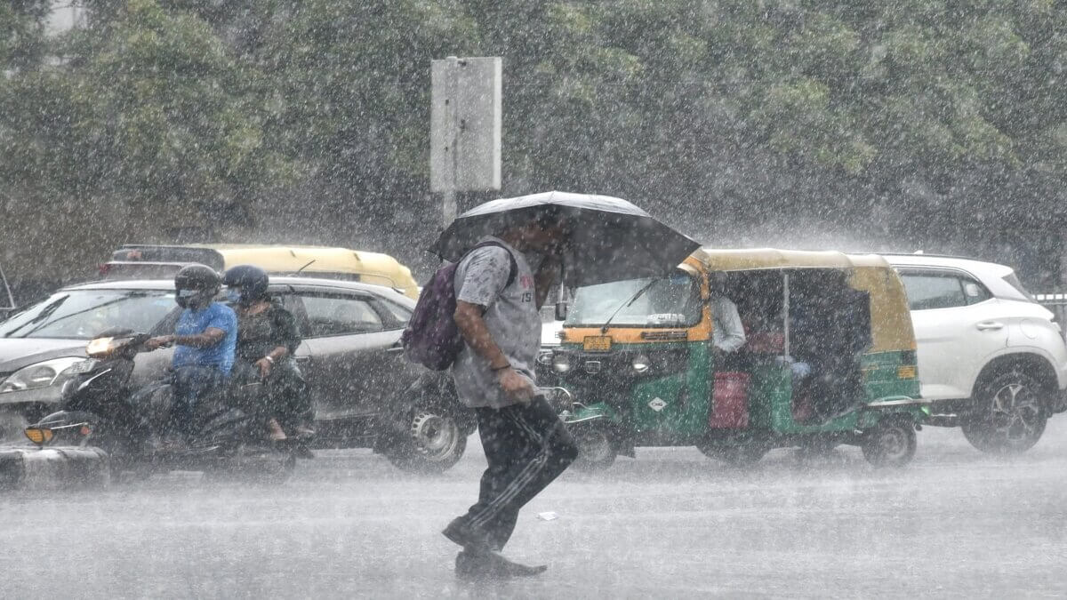
Patancheru records the highest rainfall of 7 cm on Sunday
Mon 01 Jun 2020, 11:53:40
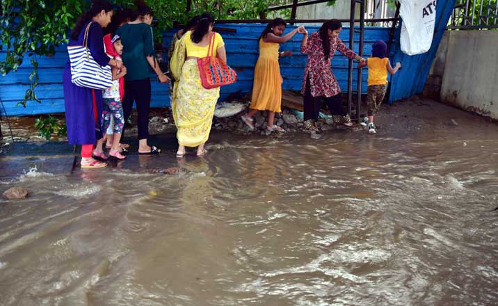
Several parts of the Hyderabad recorded moderate to heavy rainfall, much before the onset of monsoon showers. Some of the low lying areas reported water stagnation, following continuous rainfall till evening hours on Sunday.
According to Telangana State Development Planning Society, Patancheru recorded highest rainfall of 70.3 mm till 5 pm, followed by Hasthinapuram (66.8 mm), Kukatpally (56.3 mm), BHEL (54.5 mm), Gachibowli (53.5 mm) and Hayathnagar (45.3 mm).
Given the cloudy weather conditions and rainfall, temperatures in the city dropped considerably on Sunday. The mercury which kept hovering above 42 degree Celsius for last several days dropped to 37.3 degree Celsius yesterday.
The Regional Meteorological Centre said there is a low pressure area
over Southeast and adjoining East Central Arabian Sea and Lakshadweep area. It was very likely to concentrate into a depression during next 24 hours and intensify further into a cyclonic storm during the subsequent 24 hours.
over Southeast and adjoining East Central Arabian Sea and Lakshadweep area. It was very likely to concentrate into a depression during next 24 hours and intensify further into a cyclonic storm during the subsequent 24 hours.
“Conditions are becoming favourable for further advancing of Southwest Monsoon into some more parts of South Arabian Sea, Maldives Comorin area, Southwest and Southeast Bay of Bengal during next 24 hours. Conditions are very likely to become favourable for the onset of Southwest Monsoon over Kerala from June 1,” officials said.
Meanwhile, the weather warning by Regional Meteorological Centre indicated thunderstorm accompanied with lightning and gusty winds were very likely to occur in isolated places over the State.
No Comments For This Post, Be first to write a Comment.
Most viewed from Hyderabad


.jpg)


Most viewed from World


Todays Epaper

English Weekly


AIMIM News


Latest Urdu News
Most Viewed
May 26, 2020
Which cricket team is your favourite to win the T20 World Cup 2026?
Latest Videos View All
.jpg)
.jpg)
.jpg)


Like Us
Home
About Us
Advertise With Us
All Polls
Epaper Archives
Privacy Policy
Contact Us
Download Etemaad App
© 2026 Etemaad Daily News, All Rights Reserved.