


Heavy rain likely in Telangana over next 48 hours
Wed 30 Oct 2019, 11:13:59
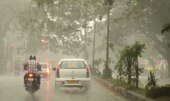
Heavy rain accompanied by a thunderstorm is likely at isolated places across the State over the next two days. Rains are expected in the State under the influence of a well-marked low pressure area over the Comorin area in the Arabian sea, which is likely to intensify into a deep depression over the next 48 hours.
The well-marked low pressure area over Comorin area and adjoining equatorial Indian Ocean with an associated upper air cyclonic circulation, extending up to mid-tropospheric levels, persists. The system is likely to concentrate into a depression over Lakshadweep Islands area and adjoining south east Arabian Sea during the next 24 hours. It is likely to move north-westwards across Lakshadweep Islands and intensify into a deep depression during the
subsequent 24 hours.
subsequent 24 hours.
As a result, Telangana State is likely to witness heavy rain at isolated places in the districts of Nalgonda, Suryapet, Nagarkurnool, Khammam, Mahbubabad, Yadadri Bhongir, Rangareddy, Jangaon, Siddipet, Medak, Sangareddy, Kamareddy, Nizamabad, Vikarabad, Mahabubnagar, Jogulamba Gadwal, and Wanaparthy. Light to moderate rain or thundershowers are very likely to occur at a few places over the State.
Since Monday, heavy rain occurred at isolated places in Jayashankar Bhupalpally district. The highest rainfall of 9 cm was recorded at Govindaraopet in the district, followed by 6 cm each in Mulug, Kondapak in Siddipet district and Yellareddy in Kamareddy district.
No Comments For This Post, Be first to write a Comment.
Most viewed from Hyderabad


Most viewed from World


Todays Epaper

English Weekly


AIMIM News


Latest Urdu News
Most Viewed
May 26, 2020
Which cricket team is your favourite to win the T20 World Cup 2026?
Latest Videos View All
.jpg)
.jpg)
.jpg)


Like Us
Home
About Us
Advertise With Us
All Polls
Epaper Archives
Privacy Policy
Contact Us
Download Etemaad App
© 2026 Etemaad Daily News, All Rights Reserved.