


Hurricane Florence: 'Life-threatening' storm starts to lash US
Fri 14 Sep 2018, 12:30:33
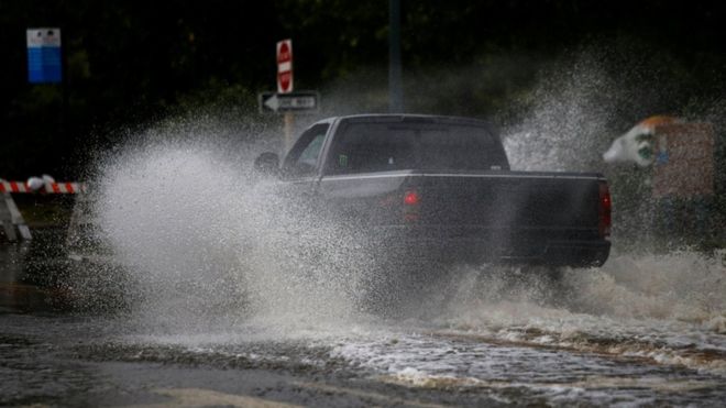
The outer bands of Hurricane Florence are lashing parts of the US East Coast.
Officials warn of life-threatening storm surges in both North and South Carolina as the hurricane moves towards land with maximum sustained wind speeds of 90mph (150 km/h).
More than 100,000 homes are already without power as weather conditions begin to worsen.
Officials have warned the storm has the potential to kill "a lot of people" amid risks of "catastrophic" flooding.
More than a million people along the coastlines of North Carolina, South Carolina and Virginia have been ordered to evacuate.
Thousands had taken shelter in emergency facilities by Thursday night.
Photographs showed residents crowded into corridors with blankets on inflatable mattresses and mats.
What is the latest?
Conditions deteriorated throughout Thursday as wind speeds gradually strengthened in coastal areas.
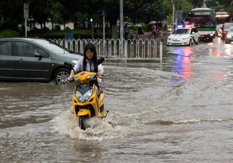
Some areas of North Carolina saw almost a foot of rain just a few hours, and footage showed sea levels begin to surge in land.
At 23:00 local time (03:00 GMT) the National Hurricane Centre (NHC) said wind speeds had slightly lowered, making it a category one hurricane.
The NHC says that despite the gradual lowering in wind strength, the storm remains extremely dangerous because of the high volume of rainfall and storm surges predicted.
"Inland flooding kills a lot of people, unfortunately, and that's what we're about to see," said Brock Long, head of the Federal Emergency Management Agency (Fema).
He said that people living near rivers, streams and lowland areas in the region were most at risk.
How bad is it expected to
get?
get?
The latest weather predictions show the storm slowing to a near standstill as it pummels the coast with "copious amounts of rain" from Thursday night to Saturday.
Wind speeds are only expected to weaken on Saturday as the storm moves slowly across land.
Meteorologists have warned floodwaters may rise up to 13ft (4m) in areas as some rivers see their flows "reversed".
Parts of the Carolina coast are expecting 20-30in (50-75cm) of rain, with isolated regions receiving up to 40in of downpour.
Myrtle Beach, South Carolina, is imposing a 12-hour curfew from 19:00 local time on Thursday.
Petrol stations in the area are reporting shortages. Energy companies predict that one to three million homes and businesses may lose power.
Officials have warned restoring electricity could take days or even weeks.
Over 1,400 flights have been cancelled, according to FlightAware.com, as most of the coastal region's airports are closed to ride out the storm.
North Carolina Governor Roy Cooper warned people: "Today the threat becomes a reality."
Emergency workers are arriving from other parts of the US to aid in rescues.
Is global warming to blame?
The relationship between climate change and hurricanes is complex.
Warmer seas power hurricanes. So, as the temperature of ocean water goes up, we might expect the intensity of hurricanes to increase in future.
A hotter atmosphere can also hold more water, so this should allow hurricanes to dump more water on affected areas.
But there are so many factors that contribute to these rare events, it has been difficult to tease out clear trends from the data.
No Comments For This Post, Be first to write a Comment.
Most viewed from International

.jpg)
.jpg)
.jpg)
.jpg)


Most viewed from World


Todays Epaper

English Weekly


AIMIM News


Asaduddin Owaisi files nomination papers on Friday
Apr 20, 2024


Owaisi Begins Election Campaign in Hyderabad
Apr 13, 2024

Bring back Indian workers in Israel: Owaisi
Apr 13, 2024
Latest Urdu News
Most Viewed
May 26, 2020
Do you think Ruturaj Gaikwad would be a good captain for Chennai Super Kings?
Latest Videos View All


Like Us
Home
About Us
Advertise With Us
All Polls
Epaper Archives
Privacy Policy
Contact Us
Download Etemaad App
© 2024 Etemaad Daily News, All Rights Reserved.