


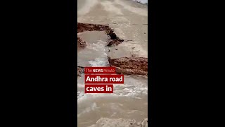
Rain likely in Telangana for three more days
Tue 15 Aug 2017, 12:18:00
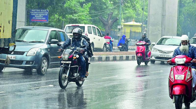
Officials at the Indian Meteorological Department have attributed the rains to an upper air cyclonic circulation over south coastal Tamil Nadu and neighbourhood, extending up to 0.9 km above mean sea level.
Another upper air cyclonic circulation lies over Coastal Andhra Pradesh and adjoining west central Bay of Bengal extends up to 2.1 km above mean sea level, while a trough now runs from Odisha to South Tamil Nadu across Coastal Andhra Pradesh and Rayalaseema.
“Due to multiple cyclonic systems, rains could intensify
further and heavy rains are expected to occur at isolated places in all districts commencing from Wednesday. Light to moderate rains are likely to occur at many places in the State,” the IMD officials said.
further and heavy rains are expected to occur at isolated places in all districts commencing from Wednesday. Light to moderate rains are likely to occur at many places in the State,” the IMD officials said.
Sircilla and Koida in erstwhile districts of Karimnagar and Khammam respectively recorded the highest rainfall of 10 cm, highest during the current season. While rains are likely to slow down for the next couple of days, heavy rains are expected to resume from Wednesday onwards and continue for the next three days.
No Comments For This Post, Be first to write a Comment.
Most viewed from Hyderabad


Most viewed from World


Todays Epaper

English Weekly


AIMIM News


Asaduddin Owaisi files nomination papers on Friday
Apr 20, 2024


Owaisi Begins Election Campaign in Hyderabad
Apr 13, 2024

Bring back Indian workers in Israel: Owaisi
Apr 13, 2024
Latest Urdu News
Most Viewed
May 26, 2020
Do you think Ruturaj Gaikwad would be a good captain for Chennai Super Kings?
Latest Videos View All


Like Us
Home
About Us
Advertise With Us
All Polls
Epaper Archives
Privacy Policy
Contact Us
Download Etemaad App
© 2024 Etemaad Daily News, All Rights Reserved.